In a special interactive feature, Federico Acosta Rainis uses satellite imagery to look at how Chinese military drills in the Taiwan Strait disrupted shipping traffic on one of the world’s major trade lanes. Click on the image above to read on.
News and updates from across Birmingham and the Midlands
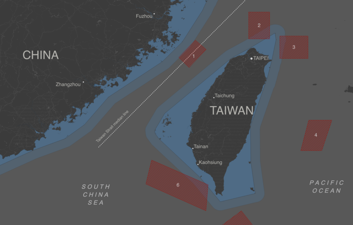
In a special interactive feature, Federico Acosta Rainis uses satellite imagery to look at how Chinese military drills in the Taiwan Strait disrupted shipping traffic on one of the world’s major trade lanes. Click on the image above to read on.